While Dark Age Europe was busy regressing, other parts of the world kept going, and stopping, at their own speeds.

(Wiki) The Da Ming Hunyi Tu world map, made in the late 1300’s, shows China at the center, with Europe & Africa tightly squeezed in on the left. The pointy part with a big hole in it, on the far left side, is Africa - so Chinese cartographers knew that it was possible to sail around that continent.


(Wiki) The Kangnido Map of the World made in Korea in 1402, based on Chinese & Islamic studies. It is considered as "superior to anything produced in Europe prior to the end of the fifteenth century"
from The History of the World in 12 Maps: At this time, Korea and China were powerful rivals. The Kangnido Map greatly exaggerates the size of Korea (while diminishing Japan) but gives equal attention to China.


http://nationalmuseumindia.gov.in/pdfs/Concept-Note.pdf the Bronze Age Indus Valley Civilization (c. 2500–1900 BCE) may have known "cartographic activity" based on a number of excavated surveying instruments and measuring rods and that the use of large scale constructional plans, cosmological drawings, and cartographic material was known in India with some regularity since the Vedic period (1st millennium BCE).
However, searching online now, I only find these Jain painting of Cosmic Man, known as Lokapurusha (Above). Very much like the European Mappa Mundi, these are meant as religious items, not navigational tools.


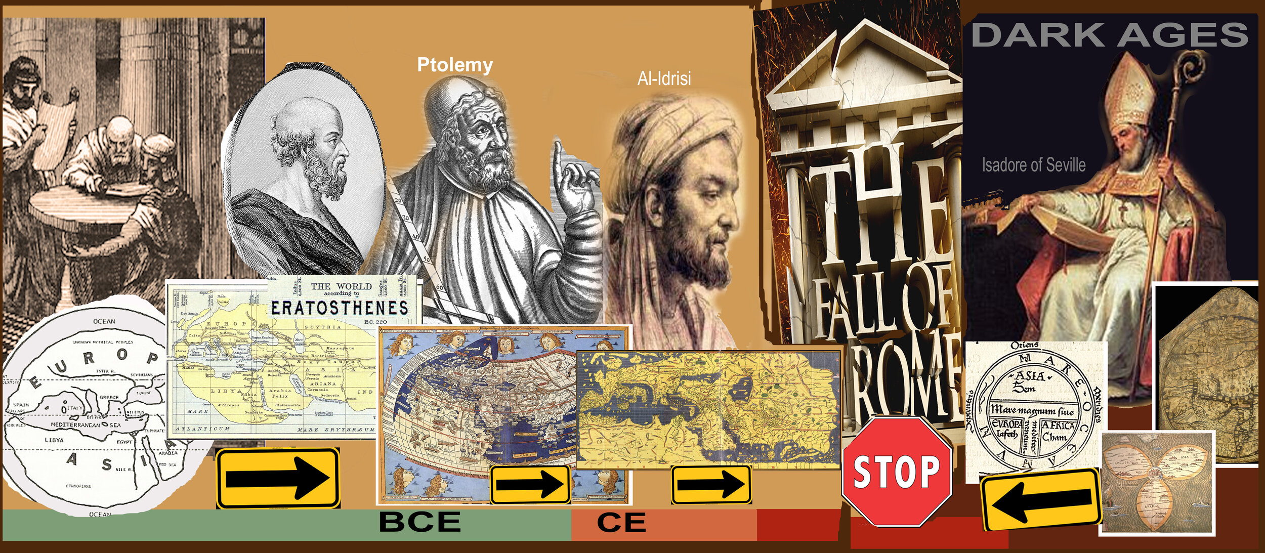
Muhammad al-Idrisi (1100 – 1165), was a Arab Muslim cartographer who lived in Palermo, Sicily at the court of King Roger II. He created the Tabula Rogeriana (Above), one of the most advanced medieval world maps, used by explorers like Christopher Columbus and Vasco Da Gama for their discoveries and voyages.


In Australia, the Aboriginal people came up with a completely different navigational tool: songlines. According to…
https://theconversation.com/how-ancient-aboriginal-star-maps-have-shaped-australias-highway-network-55952
…Aboriginal people traveled vast distances by navigating according to the stars. But instead of writing this information into maps, they embedded the facts into songs. These songs acted as mnemonic devices to help remember & teach the information.
The pattern of stars showed the waypoints (waterholes or turning places) on the route. These waypoints were used in a very similar way to navigating with a GPS, where waypoints are also used as stopping or turning points. The first European explorers had Aboriginal guides to show them the paths dictated by the stars. These songline routes were later used by drovers & settlers & eventually became tracks & then highways. and the last map for today….


Navigators in Polynesia (see map Above) have been sailing across the ocean for who-knows-how-long (one guess – since 1,000BCE). From New Zealand to Hawaii to Easter island, they navigated by the stars and sailed in catamarans.
And each navigator made their own incredible map:

Condensed only slightly from Wiki:
These stick charts represented ocean swell patterns and the ways the islands disrupted those patterns. Island locations were represented by shells tied to the framework, or by the lashed junction of two or more sticks. Individual charts varied so much in form and interpretation that the individual navigator who made the chart was the only person who could fully interpret and use it. The use of stick charts ended after World War 2 when new electronic technologies made navigation more accessible.
The stick charts are a significant contribution to the history of cartography because they represent a system of mapping ocean swells, which was never before accomplished.
The charts, unlike traditional maps, were studied and memorized prior to a voyage and were not consulted during a trip, as compared to traditional navigation techniques where consultation of a map is frequent and points and courses are plotted out both before and during navigation. Polynesian navigators used their senses and memory to guide them on voyages by crouching down or lying prone in the canoe to feel how the canoe was being pitched and rolled by underlying swells.
These last 2 - Australian and Polynesian - are mental maps: cartography that we carry in our heads.

Next week, we’re going to have a quick visit back to the old Opus. Yes, that’s still not finished, but I have progress to show you. And then we’ll get back to cartography, OK?