• GALLERY
  • BLOG
  • VIDEOS
  • ABOUT
  • CONTACT
  • RESUME

Diane Savona

  • GALLERY
  • BLOG
  • VIDEOS
  • ABOUT
  • CONTACT
  • RESUME

Maps have been used to demonstrate position, location....but they can also teach history. They can be used to hold stories and feelings about a place. 

D Savona_Wagga Map.jpg

Wagga Down Under is one of my newest maps, constructed after a visit to Australia. A wagga is a traditional Australian quilt form, made from deconstructed clothing. This one is made from my well-worn travel vest. Details here:

In ancient castles in India, royal women could only view the outside world through carved stone grills called jali. While traveling through India in an enormous white bus, I felt that I was also getting a very limited view of this amazing country. Returning home, I printed a pattern using images of tour bus windows. This cloth was set over wool, cut into and sewn to create a textile jali over images of India, printed on cloth.


1 Hiroshima 2012 med.jpg

Hiroshima 2012    86”h x 38”w

During a month in Hiroshima, I spent many days 'beachcombing' the river edges at low tide. I found ceramic shards, electronic bits...and glass fused by the blast 70 years ago. ( I checked with the museum: it is permissible to take these items). This map shows a section of the city nearest to the blast epicenter, with the rivers forming long black verticals, crossed by connecting white bridges.

Hurricane New Orleans_edited-1.jpg

Hurricane, New Orleans    46”h x 32”w

Based on a map of the Chalmette section of New Orleans. There are actual keys embedded under the cloth. Other sections have discharged images of keys and locks.

1 Tsunami Japanb.jpg

Tsunami Japan    56”h x 38”w

After the 2011 tsunami in Japan, I used my collection of Japanese fabrics to suggest an aerial view of the disaster. In Japan, purchases are carefully wrapped. In this piece, each section is also carefully wrapped - except the blackened, flooded sections, which have been ripped open, representing the losses incurred. The tan border is an old sake bag. The ceramic bits (visible below) were dug out of the sand at low tide at the Miyajima Gate.

2 Tsunami Japan detail_edited-1.jpg

detail of Tsunami, Japan 

7. Distribution Pattern of Imported Textiles_edited-1.jpg

Distribution Pattern of Imported Textiles    20"h x 15" w  

Orientation sm.jpg

Orientation    22”h x 22”w 

Map of Hometown Perceptions.jpg

  A Map of Hometown Perceptions    45”h x 56”w

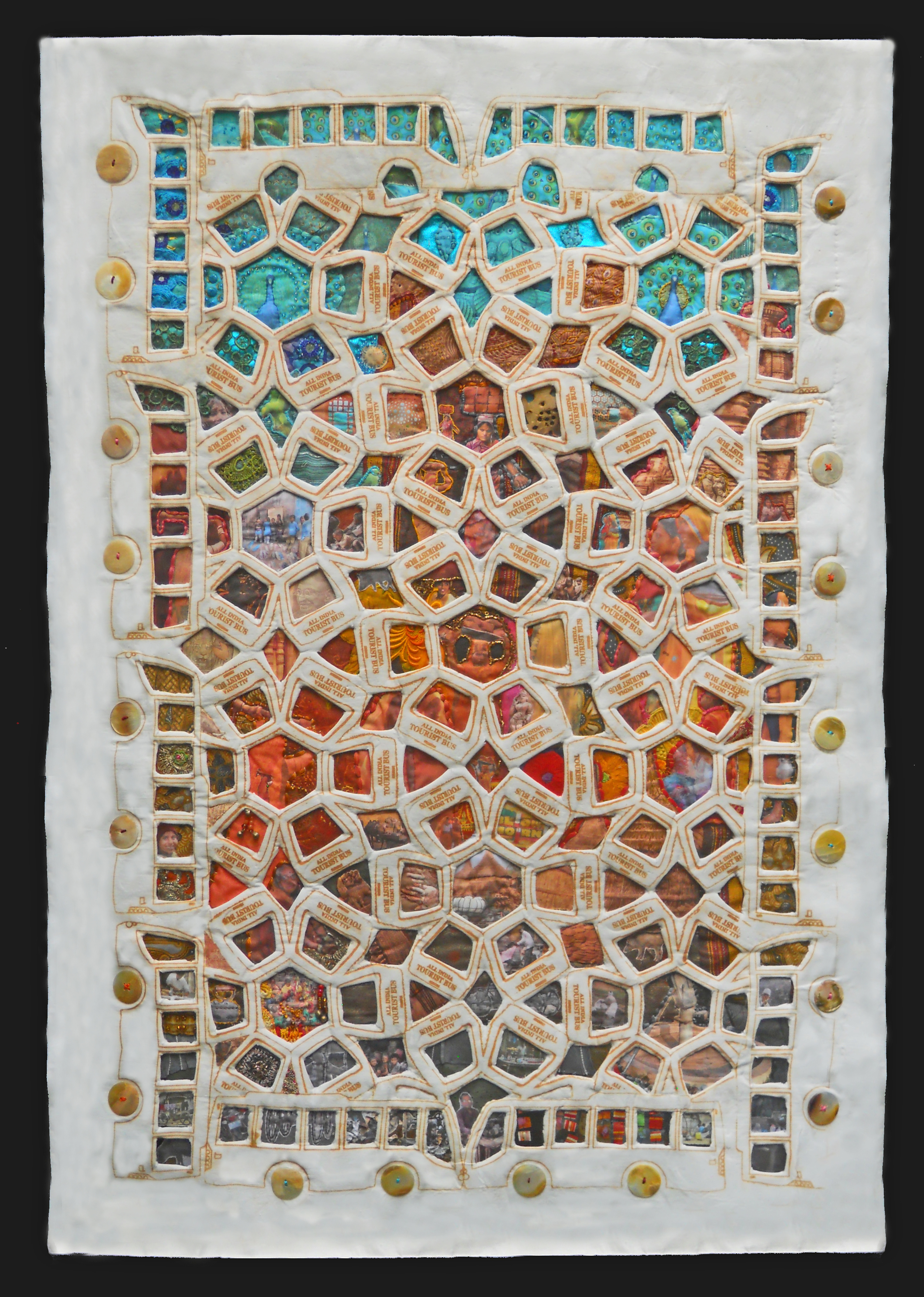
A young man told me that he is afraid to go into neighboring Paterson, which has a mostly African-American population. I’m a middle-aged woman, and feel no such danger. This map explores our subconscious feelings and prejudices, the perceptions we develop about our homes and our neighbors. Most of the materials were obtained at local garage sales.

I was raised in Clifton, pictured here as the all-white, fiercely non-integrated community of my childhood – the borders are tightly sewn with measuring tapes. Now living in the much more interesting city of Passaic, I sewed in layers of Jewish, Hispanic and African textiles. One section of Passaic is marred with soot, representing the big fire several years back. The neighboring town of Nutley is presented with a police badge, reflecting my son’s view of it as a highly regimented police state. This is one of my earliest maps.

Sign up for news from Diane!

Thank you!